Geography
Click on the topic you would like to study
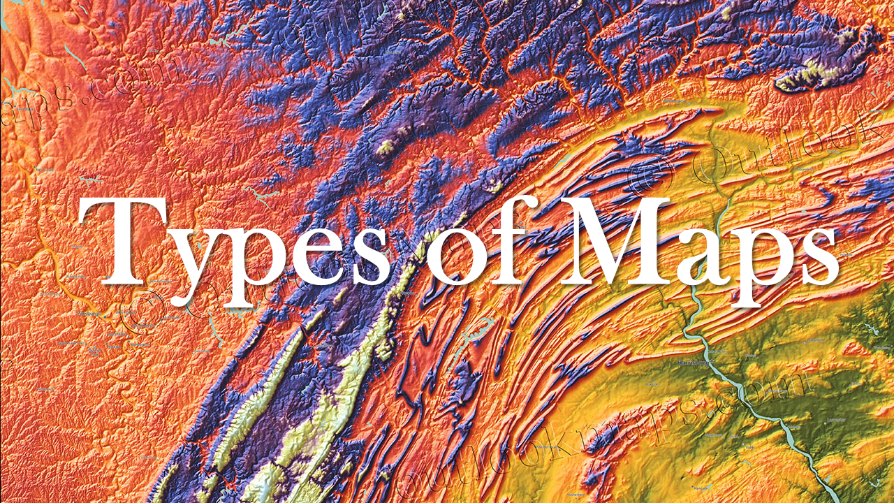
Types of Maps
There are many different types of maps, and each serves a different purpose.
- Physical maps show the land and water features of a region
- Political maps show borders or other divisions in a region
- Thematic maps show specific information in a region, sometimes about political, social or economic activities
- Cartograms show information about a region based on data instead of physical size
- Flow-line maps show the movement of people, animals, goods, religions or ideas
- Topographical maps show different elevations of a region.
|
Download the link below to see examples of all of these types of maps, and watch the video to learn about five important features that will help you read maps.
|
| ||
|
|
Check out these maps of early human migration and answer the practice questions!
| ||||
North America on the Eve of European Invasion
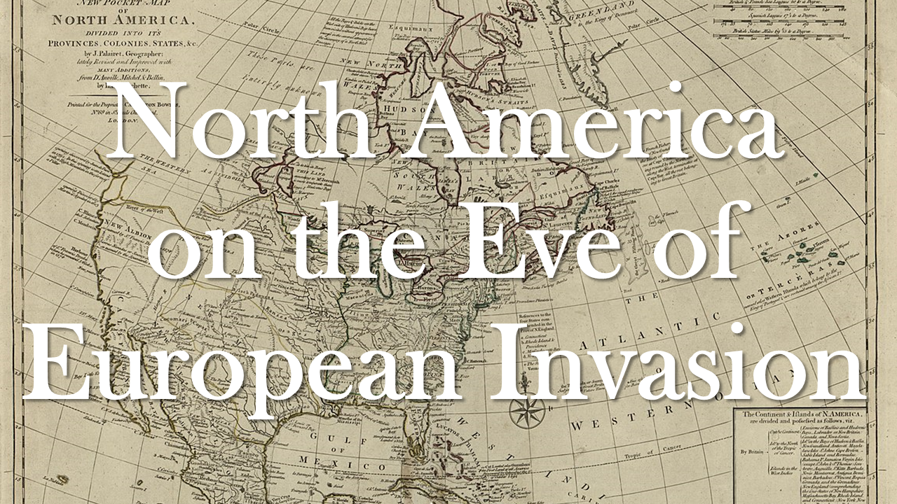
Before contact with Europeans, indigenous people inhabited every part of North America, or Turtle Island, going back at least 20,000 years. Numerous cultures and civilizations existed throughout that time period and scholars estimate that the population totaled more than 60 million prior to European contact in 1492. Disease, war and famine brought by Europeans killed more than 50 million indigenous people by 1600. Today, in what is now known as the United States, there are 574 federally recognized tribal nations and approximately 175 indigenous languages still being spoken.
|
Read about what life was like for some indigenous people prior to the arrival of Europeans in the article below, and take a look at the political and thematic maps depicting the geographic locations of many tribal nations.
For extra practice, download and answer these practice GED questions!
|
| ||||||
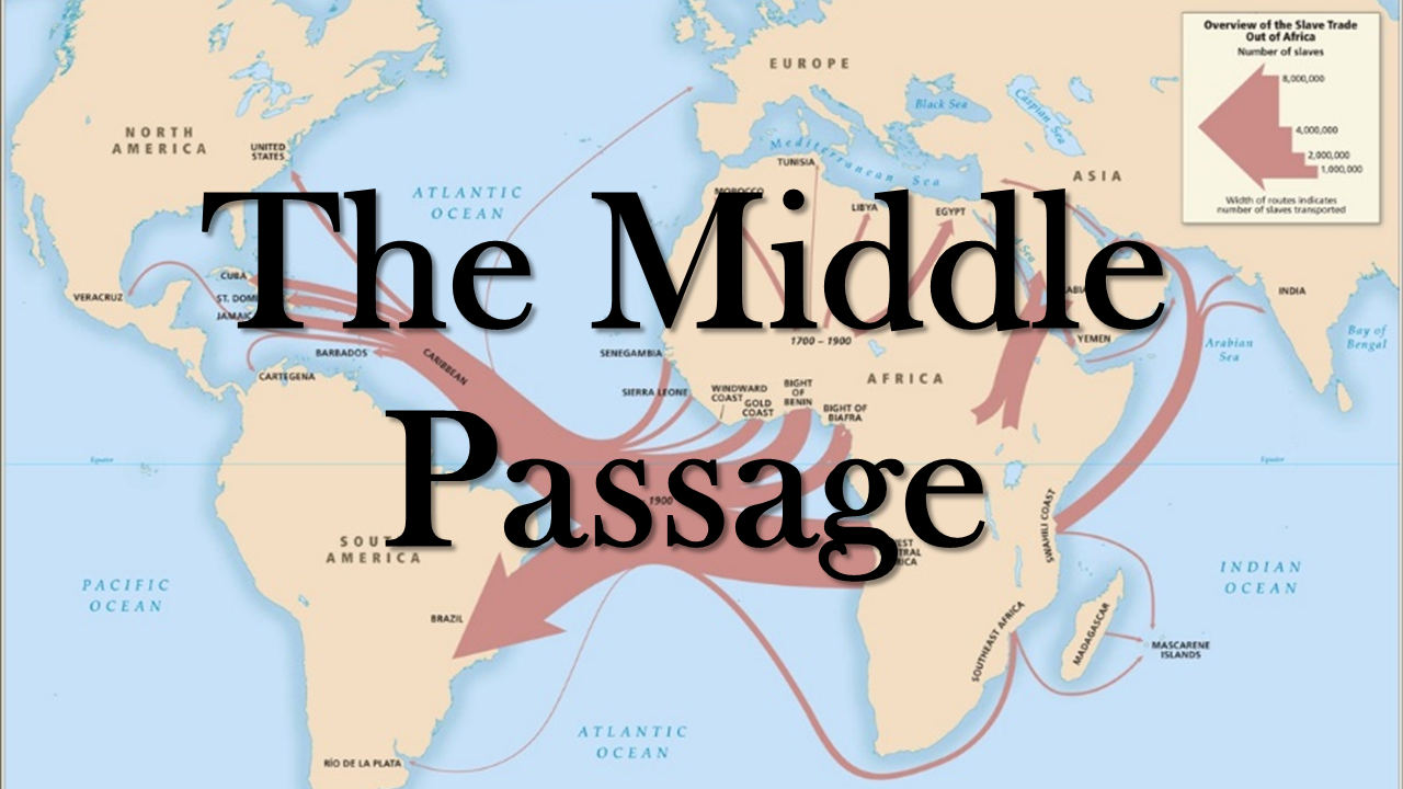
The Middle Passage
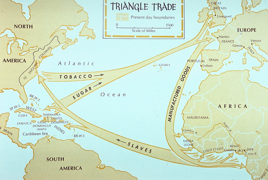
The Middle Passage was forced voyage of enslaved Africans across the Atlantic Ocean to the New World. It was one leg of the triangular trade route that took manufactured goods (such as knives, guns, ammunition, cotton cloth, & tools) from Europe to Africa, enslaved Africans to the Americas and West Indies, and finally, raw materials and resources (sugar, rice, tobacco, indigo, rum, & cotton) back to Europe. From the end of the 15th century to the mid-19th century, an estimated 12 million African men, women and children were forcibly taken on the 21-90 day journey across the Atlantic Ocean aboard grossly overcrowded sailing ships manned by crews mostly from Great Britain, the Netherlands, Portugal, and France.
Watch the video to learn about what their experience was like and download the readings for more information.
Watch the video to learn about what their experience was like and download the readings for more information.
|
|
For extra practice, download and answer these practice GED questions!
| ||||||
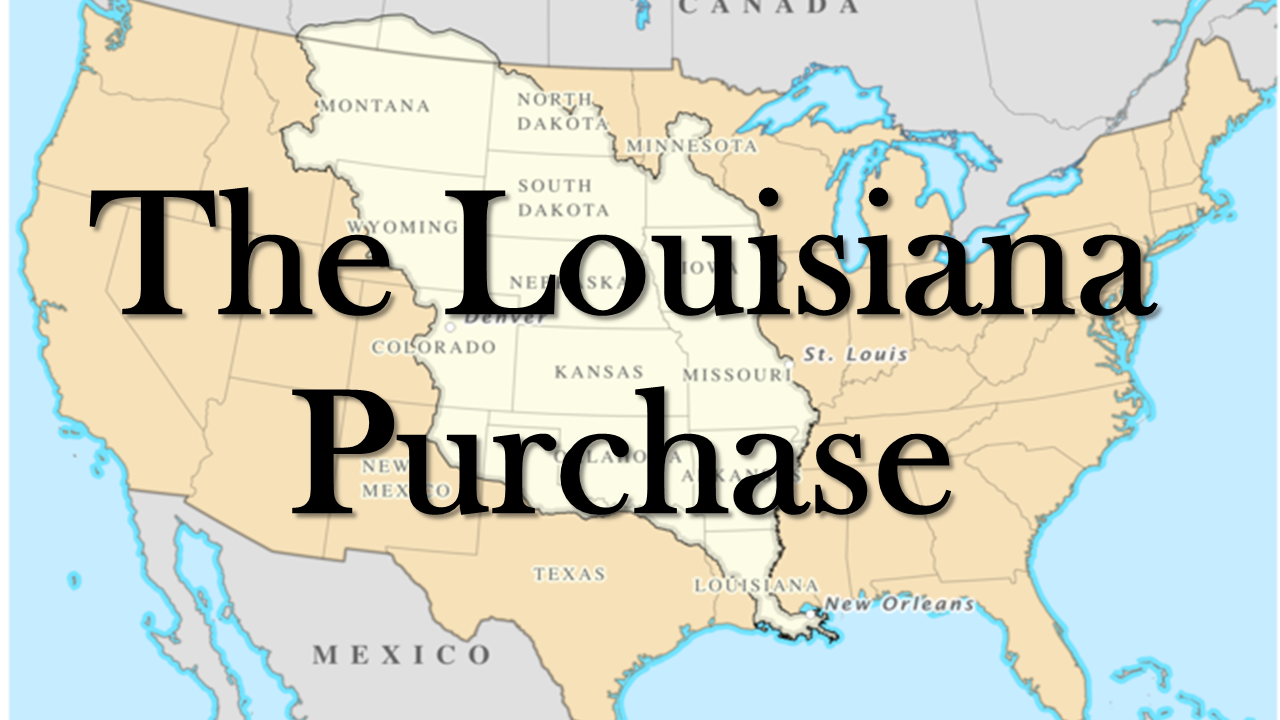
The Louisiana Purchase
In 1803, President Thomas Jefferson bought about 828,000 square miles of territory from France for $15 million, or approximately four cents an acre. This deal more than doubled the size of the United States, and 15 states were eventually created out of this territory which stretched from the Mississippi River in the east to the Rocky Mountains in the west and from the Gulf of Mexico in the south to the Canadian border in the north.
After the Louisiana Purchase, Jefferson commissioned Meriwether Lewis and William Clark to explore and map the new territory, to find a practical route across the western half of the continent, and to establish an American presence in this territory before European powers attempted to establish claims in the region. Lewis and Clark's secondary objectives were scientific and economic: to study the area's plants, animal life, and geography, and to establish trade with local Native American tribes. Discover more about the Lewis and Clark Expedition on this interactive map.
After the Louisiana Purchase, Jefferson commissioned Meriwether Lewis and William Clark to explore and map the new territory, to find a practical route across the western half of the continent, and to establish an American presence in this territory before European powers attempted to establish claims in the region. Lewis and Clark's secondary objectives were scientific and economic: to study the area's plants, animal life, and geography, and to establish trade with local Native American tribes. Discover more about the Lewis and Clark Expedition on this interactive map.
Read more about the history of the Louisiana Purchase and a primary source message from Thomas Jefferson to Lewis and Clark. Answer the practice GED questions for more practice.
|
|
| ||||||
The Trail of Tears
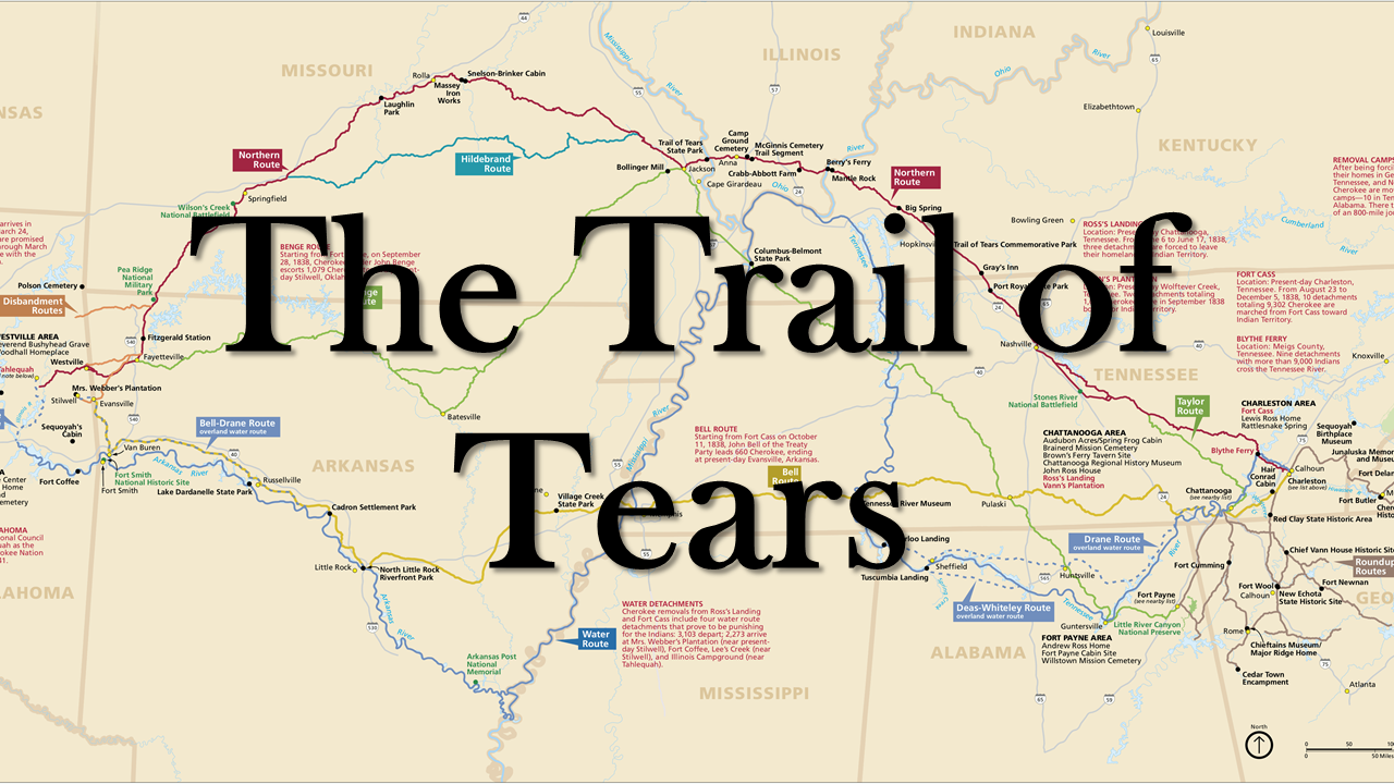
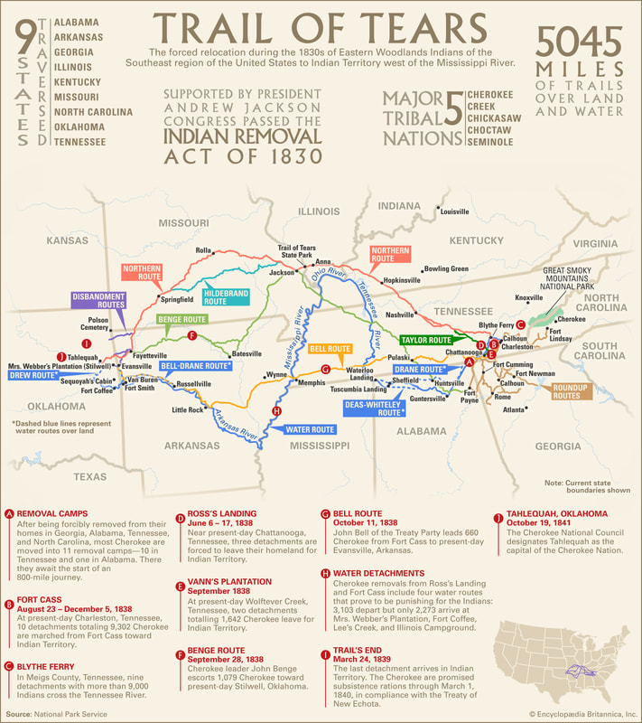
From 1830 to 1850, an estimated 100,000 Native Americans (primarily members of the Cherokee, Muscogee, Seminole, Chickasaw, and Choctaw nations) were forcibly removed from their ancestral homelands to areas west of the Mississippi River. These forced relocations were carried out by the US Government after the passage of the Indian Removal Act of 1830. The indigenous peoples suffered from exposure, disease, and starvation while on their way to their newly designated reservations. Thousands died before reaching their destinations or shortly after from disease.
The Trail of Tears was one part of these forced relocations, and the name comes from what the Cherokee called the event: nu na da ul tsun yi ("the place where they cried") or nu na hi du na tlo hi lu i (the trail where they cried). Up to 6,000 out of 15,000 Cherokee died on their march to what is now present-day Oklahoma.
|
|
Read about what the experience was like for two indigenous people from these interviews from 1937.
Look at these historic US territories maps for more practice reading maps:
| ||||||
For more information, look at this interactive map that shows the US Government's invasion of indigenous land.
The Kansas-Nebraska Act
|
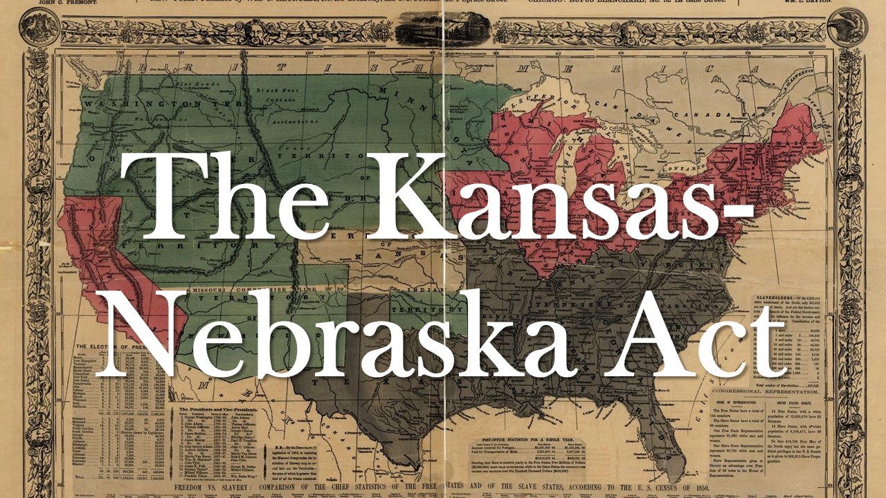
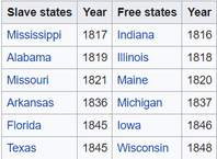
After the United States doubled in size after the 1803 Louisiana Purchase, the question of whether slavery would be permitted in the new territory was up for debate. Both free-Northern states and slave-Southern states feared the opposing side gaining more power over the other, so a compromise was struck. In 1820, Maine was admitted to the United States as a free state and Missouri was admitted as a slave state in order to maintain the balance of power in congress. This was called the Missouri Compromise, and it furthermore prohibited slavery in the Louisiana Territory north of the 36° 30´ latitude line.
|
|
|
This balance was maintained over the next several decades, with slave and free states typically being accepted into the United States in pairs. When statehood for the Nebraska territory was in question, Southern leaders had little interest in supporting it because it would be joining the country as a free state. This got in the way of railroad developers who wanted the territory to be more settled before they started building there, so Senator Stephen Douglas proposed a new compromise that would win Southern support.
|
|
The proposed Kansas-Nebraska Act allowed each territory to decide the issue of slavery on the basis of popular sovereignty, meaning that Kansas would be allowed to join the United States as a slave state despite being north of the 36°30' line. Opposition was intense, but ultimately the bill passed in May of 1854. Northerners and abolitionists were appalled by the decision, and conflict continued to grow until there was a civil war.
|
| ||||
The Mexican-American War
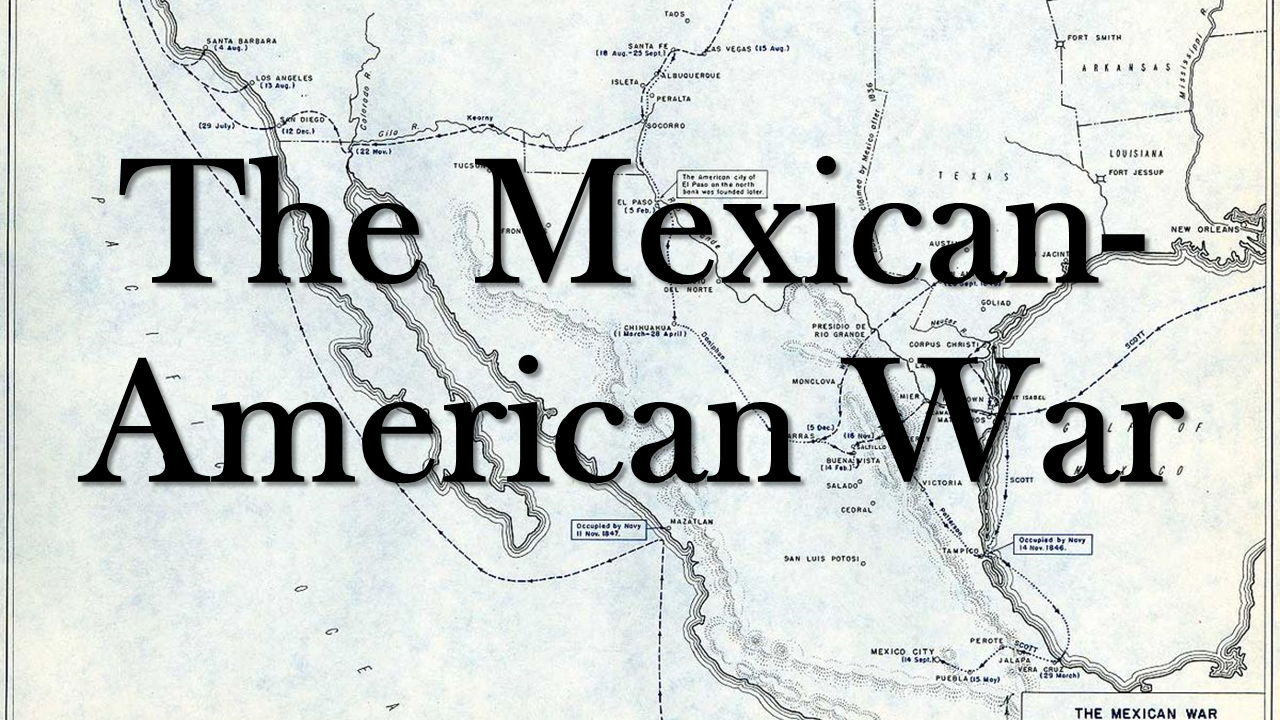
In January of 1846, President James K. Polk sent American troops into Texas to provoke Mexico into war. Polk was an expansionist and a believer in manifest destiny, the idea that Americans were predestined to occupy the entire North American continent. When Mexican troops fired on American troops on April 25, 1846, Polk used that as an excuse to start the Mexican-American War.
|
|
This justification to go to war was questionable at best. Many Northerners believed that Polk, a Southerner, was trying to gain land for the slaveholding South. Other Americans simply thought it was wrong to use war to take land from Mexico. But despite these arguments against the war, American troops were successful on the battlefield, and in September of 1847, they captured Mexico City, which ended the fighting.
| ||
The Treaty of Guadalupe Hidalgo, which you can read in the link above, was signed in 1848, and it granted enormous territory to the United States, including present-day California, Nevada, Utah, Texas, and parts of Arizona, New Mexico, Oklahoma, Colorado and Wyoming. The question over whether slavery would spread to these new territories sparked more conflict in the U.S. and would drive the North and South even further apart.
The 1915 Suffrage Map
|
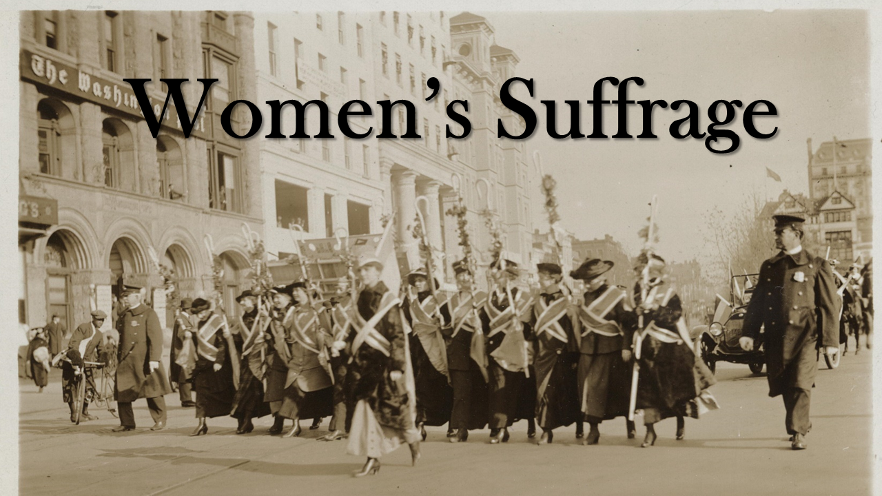
The women’s suffrage movement was a decades-long fight to win the right to vote for women in the United States. It took activists and reformers nearly 100 years to win that right, and the campaign was not easy: Disagreements over strategy threatened to cripple the movement more than once. But on August 18, 1920, the 19th Amendment to the Constitution was finally ratified, enfranchising all white American women and declaring for the first time that they, like men, deserve all the rights and responsibilities of citizenship. Nonwhite American women (and nonwhite American men) would have to wait longer for fully protected voting rights.
|
| ||||||
Geography Review
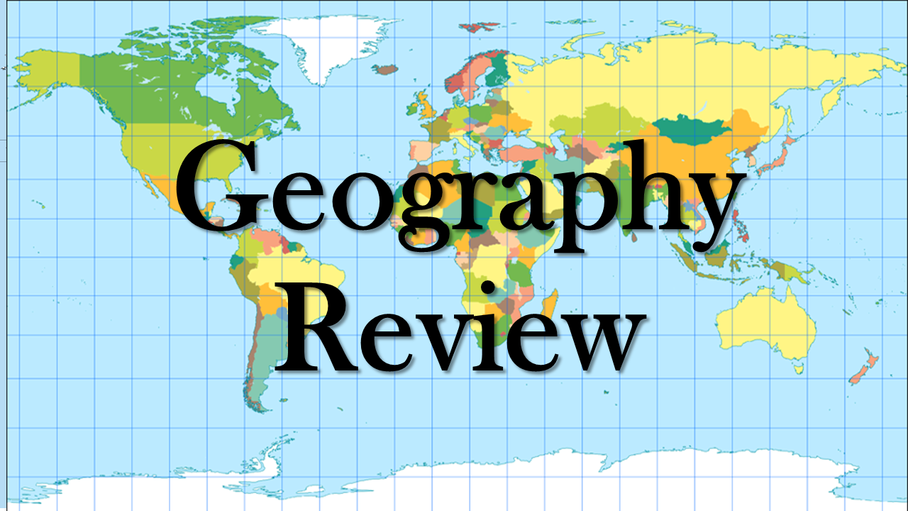
Practice your map reading skills with this GED practice test!
| map_review_test.pdf |
